Features


Range Communications
It is important that all members of your test team are able to participate in the testing. Here at the TUTR we have an extensive communications capability allowing everyone to be part of the operation.
Video Feeds
We can help you maximize your testing time and increase your efficiencies with multiple live video feeds in EO and IR. All of the feeds can be recorded for future sharing and analysis.

UAS Radar
Our state-of the-art range facility includes the Ranger® R6SS-U, a ground-surveillance radar modified to detect and track personnel, vehicles, and small UAV within a 10-kilometer range. At the range, we have it coupled to a FLIR Ranger Optics System, allowing zoom-in EO and IR sensor capabilities.
SODAR
We have a Sonic Detection and Ranging meteorological instrument used as a wind profiler to measure the scattering of sound waves by atmospheric turbulence. This allows us to measure and record winds at the Tillamook Airport from the surface to 3,000’ AGL.
ADS-B
Situational Awareness is important, knowing where your UAV is located is even more important. We have a full suite of Automatic Dependent Surveillance – Broadcast transmitters and receivers to ensure we maintain exact positional location of your UAV and other aircraft in the operating area.
Radiosonde Tracking
If you are planning operations above or outside the “local” area of the TUTR we can get real-time winds and temperatures aloft by deploying a radiosonde telemetry instrument package. This information can lower your risk and increase the value of your time used testing your UAS.
Real-time Weather
At the range, we take weather seriously. We have real-time weather being fed in from many sources locally and regionally to include an airport weather system giving local conditions as well as a SODAR wind profiler.
Location & Airspace
TUTR’s primary facility, the Johnson Near Space Center (JNSC) is located 60 Miles west of Portland at the Tillamook airport (KTMK). KTMK is an uncontrolled Airport, 3 miles south of Tillamook co-located with the Port of Tillamook Bay Industrial Park/Blimp Hanger. The operations area covers 32,000 square miles in Western Oregon, from Coast to Cascades and Columbia River to California border.
Local airspace is Class G and E with access to Class D, and High Altitude Operations extending through above Class A. The test range has the flexibility to operate in many environments over a very large operations area. We operate under three pre-coordinated LOAs, access to Special Use Airspace (W-570), and a 32,000 square mile operations area allocated to the test center by the FAA.


Range Ammenities
Flight Test / Research
- Low, Medium, and High Altitude Flight Testing
(SFC to 130,000’) - UAS Integration & Operations from Uncontrolled Airports
- BVLOS and Escorted Operations with Manned Aircraft
- Emergency Management / Public Safety
- Disaster Preparedness, Training, Search & Rescue, Infrastructure Inspection, First Responders, Law Enforcement
- Technology Development and CONOPS for UAS Integration
Portland Metro
Portland Metro AREA (75mi)
- PDX—Portland Int’l Airport
- KTMK—Tillamook Airport (on-site)
- (5000’ & 4000’ Paved Runways/RNAV-GPS Approach/AWOS/PAPI & Taxiway lighting/New FBO/100LL & Jet A/Hangars /Rental Cars)
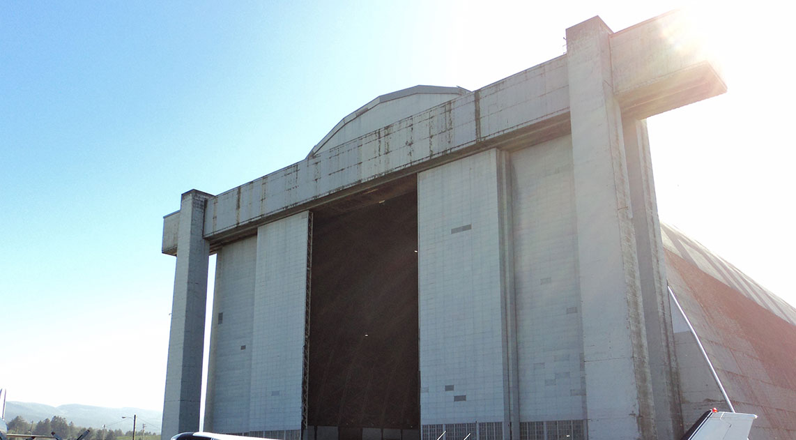
- Port of Tillamook Bay (POTB)
- TNAS Blimp Hangar (Air Museum, Café)
- New Light Industrial Park (Office/Fabrication/Storage)
- Meeting Spaces (Conference/Classes)
- UPS Facility (on-site)
- Gym
- City of Tillamook
- Lodging (Customer Rates Available)
- Restaurants/Breweries
- Industrial Base (supplies/machine shops)
- Tillamook Bay Community College